


An Incomplete History of the Portland Parks
- Announcement
- Apr 30, 2021
- 9 min read
Updated: May 2, 2021
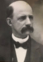
Photo: Dr. Alton
Alton Park: Alton Park originated from a small park called Dilley’s Grove. The Grove was owned by Josiah Dilley a successful businessman in Portland. In the “History of Portland Book” it states that the land for Alton Park was donated by William and Elizabeth Toan and John and Grace Toan. However, I believe this is incorrect. In a March 18, 1925 article in the Grand Rapids Press, it states that the money to buy Dilley’s Grove was raised by Leo Lehman and Fred Rowe and other members of the Exchange club and Chamber of Commerce. It was to be named after Portland Physician Robert Alton 1854-1930. because, “he is the town’s most popular speaker and the naming of the park after him would show what high esteem he’s held in.” (As a side note-he was also a businessman and a partner in the Ramsey-Alton Company)
The park used to have camping spots and I suspect it used to be larger. Torp-Smith camped there when visiting Gerri one year. It currently has 2.2 acres. In the 1940’s, the Newman Fountain, which had been in pieces after being moved from another location, was rebuilt in Alton Park and stands there today. It was dedicated to James Newman who was President of the Portland Milling Company at the time of his death in 1907 and a son of the pioneer Portland settler James E. Newman.

Photo: Skating at Powers Park 78-79
Powers Park Most documents say that the land was donated by Charles Powers, who owned a pharmacy on Kent Street until he sold it to Carl Bywater and moved to Muskegon where his daughter was a doctor. However, the original portion of the park was deeded by Plunnia E. Cole on July 29, 1926 and Ernest and Sarah White on May 28, 1926. Charles Powers sold 2 and 1/2 lots to the city for $1. In 1981, Donald and Elmere Wright sold lot #26 (which was the site of the Kelland home) to the city and this increased its length. It has 2.68 acres (pg. 55 The History of Portland). In her will, Dr. Powers left money for the city to construct an arch entrance to the park in memory of her parents. The will was contested and not settled for 7 years. The city eventually received $5000. which was not as much as the doctor intended, and the metal arch became the entrance it has today. (History of Portland) The park has undergone many improvements over the years. One was done as an Eagle Scout project by Derek Bullen when “he constructed a scorekeeper’s box, installed some steps and created a small, enclosed garden area in front of the park monument.” (Portland R&O 18 February 1991)
In a recently discovered history of the West Side of Portland written by J.B. Matthews in 1933, he details which buildings were demolished to make way for the park. I quote “On the site now known as Power’s Park was the lumber yard of Milt. (sic) Heath, Contractor and builder. Later this passed to Love and Gay and finally to C.A. Estep and son who moved the building to the present site of builders Lumber and Supply Co., where F.E. Caswell also conducted a lumber yard.
North of Heath’s lumber yard was the Goff House, later called the National Hotel, which finally became the home of the Turkish Remedy Co., owned and operated by the late W.W. Tariff. This building was wrecked when the Powers Park was cleaned up. North of this hotel building was a small store, and west of it a large barn formerly conducted by the hotel, theses were also wrecked when the plot was cleaned off for the park.
In the sourthwest corner of Powers park the present home of John Soughders, Clarence B. Kelland of Scattergood Baines’ fame was born July 11, 1881. When the park was purchased, an effort was made to obtain this house but to no avail, as Mr. Soughders refused to sign off at that time. “
I think this description helps us to orient ourselves when we look at the old pictures of the West side.

Photo: Verlen Kruger Statue
Thompson Field Is located along Canal Street. The property was sold to the city of Portland in July of 1970 (Portland R&O July 9, 1970) by Marion Thompson. It was purchased with profit money from the Portland Centennial Celebration and named in memory of Paul Thompson who died in July of 1969. He had been on the Village Commission for 8 years. The Centennial Committee earmarked funds for development of this recreational area. I believe a Lansing State Journal article dated July 27, 1970 incorrectly stated that the committee was going to purchase “4.5 acres of land along Water Street to develop baseball fields, picnic areas, parking facilities and a canoe dock…to be deeded to the city and named Bud Plant Field”. In 1984, permission was given to Greg Stiffler to renovate two old scoreboards and build a new scoreboard for Field #2 as an Eagle Scout project (Parks and Recreation Minutes July 19, 1984). It contains 6.2 acres and has a pavilion constructed by Brandon Logan for his Eagle Scout project. It also contains the Verlen Kruger Memorial and statue which was dedicated in 2010. It also has a canoe launch from which Dan Smith used to operate a canoe rental business.
Tichvon Park: named for Mayor Joe Tichvon, who served as Mayor for 14 years and had been a member of the Village Council and the City Council. Originally called Carl Street Park it’s located at Carl Street, West and Grape. It has 1.27 acres. It was picked up by the city for back taxes in 1988. (The History of Portland). In March of 1991, the City Council committed $21,000 to the building of the Carl Street Park. A grant from the DNR paid $65,000 in project fees and the city planned on using in-kind services to meet and match its obligations. (25 March 1991 Portland R&O) I don’t know when the name change took place.

Photo: William Toan Park
William Toan Park: located at the intersection of Grand River Avenue and Water Street has .78 acres and includes a pavilion and picnic area. A chime sculpture, which was shown in Art Prize, and donated by the Portland Arts Council and Rush and Julie Clement is located there. In an article and picture dated Nov. 15, 1979 , former city manager Rex Wambaugh is clearing vegetation along the river on land donated by Bob Jones across from Powers Park. This prompted a phone call to Mr. Wambaugh. He stated that in the picture he and some Boy Scouts were clearing the land for the future Toan Park. He explained that the land at the south end of the park from the bridge to about the pumping station had always belonged to the city, but that the land from about where the bathrooms are to Grand River had belonged to the Noren family. Their house was on the property. Carl Noren sold the land to Bob Jones. Mr. Jones had planned on building on the property but couldn't because of environmental concerns so he donated it to the city for the park. The funds for the playground equipment were supplied by the Toan Foundation. William Toan was a well know businessman and farmer who, when he died in 1956, left money in his will to be used for the children of Portland.
Roadside Park between Frosty Boy and the Walking Bridge has .25 acres and includes frontage along the Grand River.
Boy Scout Park is 1.91 acres of green space located along Canal Street with frontage along the Grand River. It contains a pavilion, which was built as an Eagle Scout project by Nick Weaver. In 1964, the scouts received permission to use the old police building on Canal to store materials. (June 19, 1964 Commission minutes) In April of 1991, the city council agreed to “purchase a small section of land running from Bridge Street to Thompson’s Field” from the Boy Scouts of America for $450. The Boy Scouts had obtained it from the Commonwealth of Michigan in 1957. (8 April 1991 Portland R&O). I don’t know if this is the same property., but I suspect it is.
Brush Street Park: is .89 acres located on part of the site of the Old Brush Street School. The Brush Street Building Committee decided “that the most beneficial for both the community and the school district …that part of the Brush Street property would be retained for public use and recreation by developing the easterly portion as a neighborhood park with the use of anticipated grant money.” (Portland R&O 25 March 1991) According to the History of Portland book, the transfer of land was completed in September of 1992.
Photo: Swimming at Community Park 1978
Community Lake Park has 23 acres it was added in 1971 and is located on Rowe Street. The Village Commission was shown an aerial view of the proposed park in February of 1964. In 1965, a newly formed park commission received a deed to the property. In 1970, the Portland Parks and Recreation Board wanted to assume responsibility for the park as Portland’s primary recreation facility.
It used to have a large lake where many people enjoyed swimming. It was drained and no longer exists.
Riverfront Park has .51 acres and was deeded to the city for $1 by Anthony and Lucille Smith. On Water Street along the Grand River. Greenspace and Parking on Canal Street (History of Portland)

Photo: 24-Scout Park
Girl Scout Park on Kent Street known as “Scout Park” where 2 buildings were demolished, Hosleys at 171 Kent in 1993 and Bandfield’s at 163 Kent in 1979. This information was provided by Janet Ogden, the City Assessor. In November of 1983, Girl Scouts Kelly White and Melissa Brown were given permission by the city commission to “place trees, flowers, tables, etc in the space between Scotts Hardware and the antique dealer” for their Golden Arrow project. This was accomplished in 1984 and they were awarded their Golden Arrows. In a November 18, 1992 article in the Lansing State Journal, it was reported that the Portland Garden Club along with local Girl Scouts have been working over the last two years to refurbish the park. In 2017, it went through another renovation and in September of 2019 an historical marker detailing Portland’s history was placed there as part of the Sesquicentennial celebration.
Bogue Flats Recreation Area: created in 1922 it is the largest and probably the oldest park. It is named after Philo Bogue a Portland pioneer and contains Bud Plant Field which was moved there from its previous location by TRW when TRW expanded in 1965.

Photo: 911 Memorial
Two Rivers Park between 9/11 Memorial and Divine Highway has the band shell, Canoe and Kayak launch. This was funded through many grants. The land was bought for $200,000. from Larry Barley the owner of Barley Earhart and a former village president.
At one time, there was an Indian burial ground near where the band shell is located. Elisa Newman, an early pioneer, had it fenced off “so that cattle and hogs couldn’t damage the graves”. What happened to it?
It is also the location of the 911 Memorial. The money for the Memorial was raised by the Portland Fire Department and installed by members of the department under the leadership of Chief Mark Ackerson. It was dedicated September 2003. Something interesting I learned from Mark is that an aerial view of the sidewalks next to the memorial show that they form the numbers 911.
Next to the 911 Memorial is the War Memorial dedicated to local soldiers killed in wars.
Portland River Trail “Is a linear park featuring more than 9 miles of paved trailway throughout the city. It has a 10-foot wide ADA accessible asphalt trail that connects many of the schools and parks within Portland” (Portland City Guide) The trail began as Doug Carr’s Eagle Scout project in 1984 and the last piece was put in place in 2010. It has been funded through a series of grants.
Found in May 1994 Portland City Newsletter:
“Rails to Trails and Riverwalk project to start soon: After two years of waiting, the paving of the railroad grade through town and the construction of the Riverwalk from the old railroad bridge upstream to the Thompson Field area is scheduled to begin by June 1st of this year. Completion dates is scheduled for August 1st. Improvements to the railroad bridge and installation of a bridge over the Looking Glass River is scheduled to begin by July 1st and be completed by the end of September. Funds for these projects come from the Downtown Development Authority bonds, a grant from the DNR and a grant from MDOT. Totals costs for both projects is projected to be $500, 000.
As a note, Eagle Scouts and Golden Arrow Scouts are responsible for many of the improvements made to the parks over the years. Different ones have built pavilions, scoreboards and trails and one even built a park behind the library. That one was destroyed when the library was expanded. In addition, scout troops have helped clear the land in many of the parks and one troop even provided the seed money for the building of our beautiful pavilion. A big thank you to the Girl and Boy Scouts of Portland and to their leaders.
This piece is an edited narrative of Margaret Sheffer's talk at the Portland Area Historical Society meeting on April 27th.


